German Topo Maps for PC


Game Info
Easy to use Outdoor/Offline GPS navigation app with access to the best topographic maps and satellite images for Norway.
++ For offline use PRO features needed ! ++
Turn your Andoid Phone/Tablet into an outdoor GPS for trips into the backcountry WITHOUT CELL COVERAGE. See your position on different maps, record your track or share your location with others.
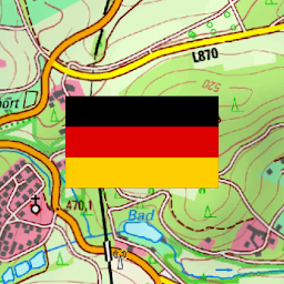
Over 50 different map layers for Germany. 10 map layers with worldwide coverage. Plus many overlays like trekking or bicycle routes.
Use official topographical maps to find small pathes, creeks or contour lines.
High resolution aerial imagery, topo maps in up to 1:5.000, digital terrain modells and even cadastre maps for many German states !
OpenStreetMaps with different layouts.
Free map layers for all Germany
• TopPlus: These high resolution maps use best available geodata from German surveying office (BKG)
• WebAtlasDE
• Satellite imagery
• OpenStreetMaps : These crowdsourced maps are a very useful addition to other map layers. Contain many unique features.
• OpenCycleMaps: These maps are ideal to plan bicycle trips (PRO Users only !)
• ESRI Topographic
• ESRI Aerial Images
• ESRI Street Map
• Google Road Map (online access only)
• Google Satellite Images (online access only)
• Google Terrain Map (online access only)
• Bing Road Map (online access only)
• Bing Satellite Images (online access only)
• Earth At Night
• lots of Overlays like hillshading, rivers, lakes, routes, ...
Main features for outdoor-navigation:
• Create and edit Waypoints
• GoTo-Waypoint-Navigation
• Track Recording (with speed, elevation and accuracy profile)
• Tripmaster with fields for odometer, average speed, bearing, elevation, etc.
• GPX/KML/KMZ Export
• Search (placenames, POIs, streets)
• Customizable datafields in Map View and Tripmaster (e.g. Speed, Distance, Compass, ...)
• Share Waypoints, Tracks or Routes (via eMail, Whatsapp, Dropbox, Facebook, ..)
• Display coordinates in Lat/Lon, UTM or MGRS/USNG (Military Grid/ US National Grid)
• Record & share tracks with statistics & elevation profile
• Rotate map (Track Up & North Up)
• Get Elevation and Distance by long click on map
• Track Replay
• Add custom map tile servers
• and many more ...
Available Pro features: (Pro features available via In App Purchase)
• Offline Use - no cell coverage needed. No Roaming fees !
• Easy+Fast Bulk-download of map tiles for OFFLINE USAGE (not for Google and Bing maps)
• Create and edit Routes
• Route-Navigation (Point-to-Point Navigation)
• GPX/KML/KMZ Import/Export
• unlimited Waypoints & Tracks
• Add other Map Tile-Server
• No Ads
Offline Use:
All viewed map tiles are kept in cache. To cache large areas you need to purchase Pro features.
Use this navigation app for outdoor activities like hiking, biking, camping, climbing, riding, skiing, canoeing, hunting, offroad 4WD tours or search&rescue (SAR).
Add custom waypoints in longitude/latitude, UTM or MGRS/USNG format with WGS84 datum.
Import/Export/Share GPS-Waypoints/Tracks/Routes in GPX or Google Earth KML/KMZ format.
Preload FREE map data for areas without cell service (Pro feature !).
Comments and feature requests to info@atlogis.com
Have a look at our other outdoor navigation apps: https://play.google.com/store/search?q=atlogis
+++ We DO NOT track any user activities or collect any user data ! +++
Games Related to German Topo Maps


How to Download and Play German Topo Maps on PC
- 1Download and install LDPlayer X on your PC.
- 2Enter and search for German Topo Maps in the search bar at the top left corner.
- 3Click on "Install" to download German Topo Maps automatically.
- 4Once the installation is completed, click on "Open".
- 5The game will be launched in LDPlayer automatically. Enjoy!
- 6You can also click on the game icon of German Topo Maps in LDPlayer homepage to start playing.
Advantages of Playing German Topo Maps on PC with LDPlayer X
Wider Screen
The larger PC screen allows you to capture clearer visual details in German Topo Maps.
Customized Control
Play games with mouse, keyboard & controller with your own customized setting, guaranteeing a gaming experience for German Topo Maps comparable to actual PC gaming.
Multi-instance & Synchronizer
Log in to multiple game accounts or play multiple games at the same time. A great time saver for rerolling.
Higher FPS
With more realistic and smooth visual effect, and more coherent action, visual experience and the sense of immersion for German Topo Maps is greatly optimized.
Game Assistant
Use scripts to simplify complex task processes and complete tasks automatically. Enjoy your game with ease.
Video Record
Record highlights or operation processes in German Topo Maps to share with your friends.
Computer Configuration for German Topo Maps PC Version
System
Win10 64-bit or higher, including OpenGL 4.xSystem
Win7 / Win8 / Win8.1 / Win10CPU
8th Gen Intel Core i3-8100 4-core or higher, with VT enabledCPU
Intel or AMD CPU Processor x86 / x86_64, with VT enabledGPU
NVIDIA GeForce GTX1050 Ti 2GB or higherGPU
Windows DirectX 11 / OpenGL 4.0 Graphics DriverMemory
8GB or moreMemory
At least 2GB RAMStorage
10GB or more available space for installation disk, 2GB or more available space for system diskStorage
At least 1GB available memoryMore From ATLOGIS Geoinformatics GmbH & Co. KG


You might also like


More popular games

Free Fire

PUBG MOBILE

Mobile Legends: Bang Bang

Among Us

Brawl Stars

Clash of Clans

GODDESS OF VICTORY: NIKKE

Call of Duty: Mobile Season 2

Free Fire MAX

PUBG MOBILE LITE

Minecraft: Play with Friends

CookieRun: Kingdom

Ragnarok M: Eternal Love

Epic Seven

Roblox

Call of Duty®: Mobile - Garena

Arknights

Ragnarok X x Re:Zero

Clash Royale

Black Desert Mobile

Apex Legends Mobile
German Topo Maps - FAQ
Q: Is LDPlayer X safe for players?
Q: Can I play German Topo Maps on PC?
Q: Why is LDPlayer X the best platform to play German Topo Maps on PC?
The powerful built-in Android emulator lets you immerse yourself in every small detail of the game.
Additionally, it allows you to simply play numerous popular games in your browser, such as Brawl Stars and Roblox.
You can also enjoy the best top-up discount for popular games on LDShop.